Learning in the Field: Assessing the Impact of Agroforestry Systems Through Scientific Methods
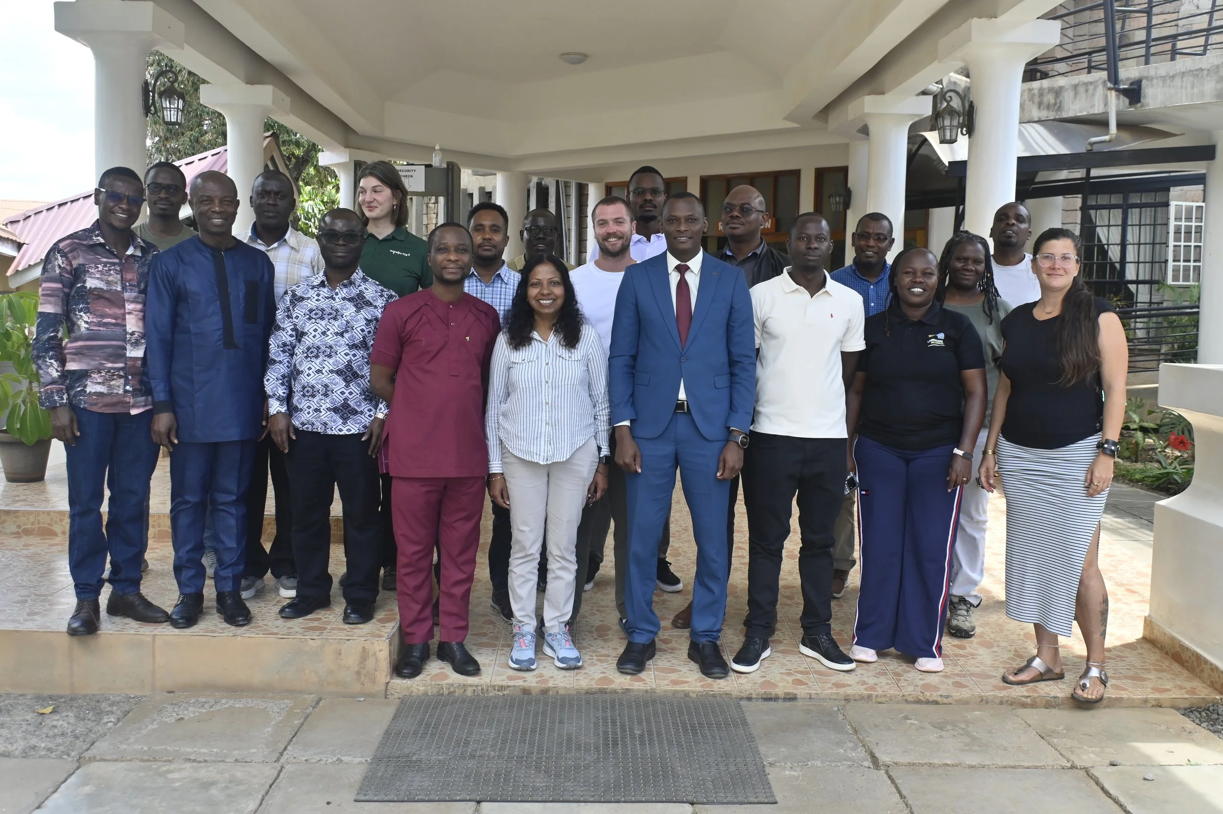
Photos by: Kelvin Okumu, Landscape Alliance (CIFOR-ICRAF)
Indigenous agroforestry systems have been delivering a myriad of benefits to people and the planet for millenia, including balancing socioeconomic needs with soil conservation, hydrologic stability, and sustained biodiversity. These systems are best supported through locally-led action and locally-adapted approaches.
The AfroGrow project promotes sustainable agroforestry ecosystems in six African countries, Zambia, Botswana, Kenya, Ethiopia, Côte d’Ivoire, and Senegal, by implementing in-country Living Labs. It brings together farmers, local communities, researchers, policymakers, and other stakeholders to co-create locally appropriate solutions that can enhance food security, strengthen livelihoods, support biodiversity, and improve soil health, using the Living Labs as integrated learning spaces. The initiative is coordinated by the Eratosthenes Centre of Excellence (ECoE), with the Landscape Alliance (CIFOR-ICRAF) serving as co-coordinator for African partner organizations. The partner consortium is represented by over twenty-five partners.
The project’s approach includes robust monitoring of biophysical, vegetation, and climate indicators to assess the efficacy of the agroforestry systems and approaches being applied in context. This also enables reliable, cross-site comparisons of soil physical properties, soil moisture, vegetation, microclimate, and meteorological data, which supports adaptive management and cross-country learning.
From 23-29 August 2026, the AfroGrow project hosted an in-person training workshop in Makueni, Kenya to foster knowledge exchange between the project countries, facilitate collaboration, and bring to life the tools and protocols that support multifunctional agroforestry systems monitoring.
About the Workshop
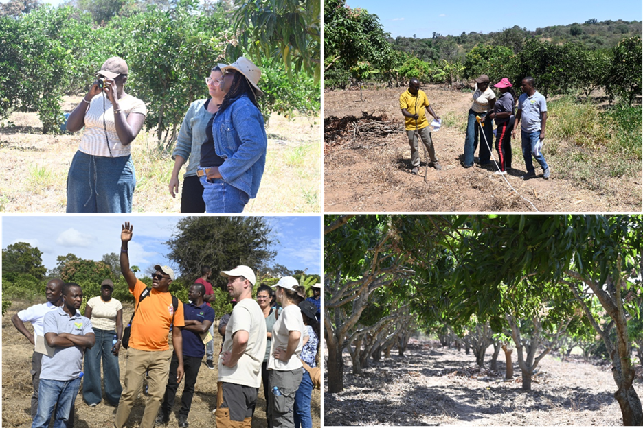
Assessing the field site.
The workshop was hosted by CIFOR-ICRAF and led by the Czech University of Life Sciences Prague (CZU). The participants represented institutions including the International Centre of Insect Physiology and Ecology (ICIPE), Botswana International University of Science & Technology (BUIST), Senegalese Agricultural Research Institute (ISRA), Elephants for Africa (ELA), Fundació Centre de Recerca en Agrotecnologia (AGROTECNIO), University of Heidelberg (UKHD), Golden Valley Agricultural Research Trust (GART), West and Central Africa Council for Agricultural Research and Development (CORAF), WEFOREST, Hawassa University, and the Federal Institute of Technology Zurich (ETHZ).
Workshop participants were welcomed to Makueni by Dr. Geoffrey Ngovi Muthoka, Chief Officer of the Department of Environment and Climate Change of Makueni County, and by Phyllis, who is the farm owner at the Makueni Living Lab site. Participants learned criteria for selecting field sites, how to set up a field site and plot, and which data about the field site to record, including slope, GPS coordinates, land ownership, managemet practices being applied, and vegetation.
The key field-based training areas included in the workshop were: soil and water health monitoring, vegetation assessment, insect biodiversity monitoring and bioprospecting, measurement of climatic conditions, bioacoustics for biodiversity assessment, heat-stress assessment, and data management.
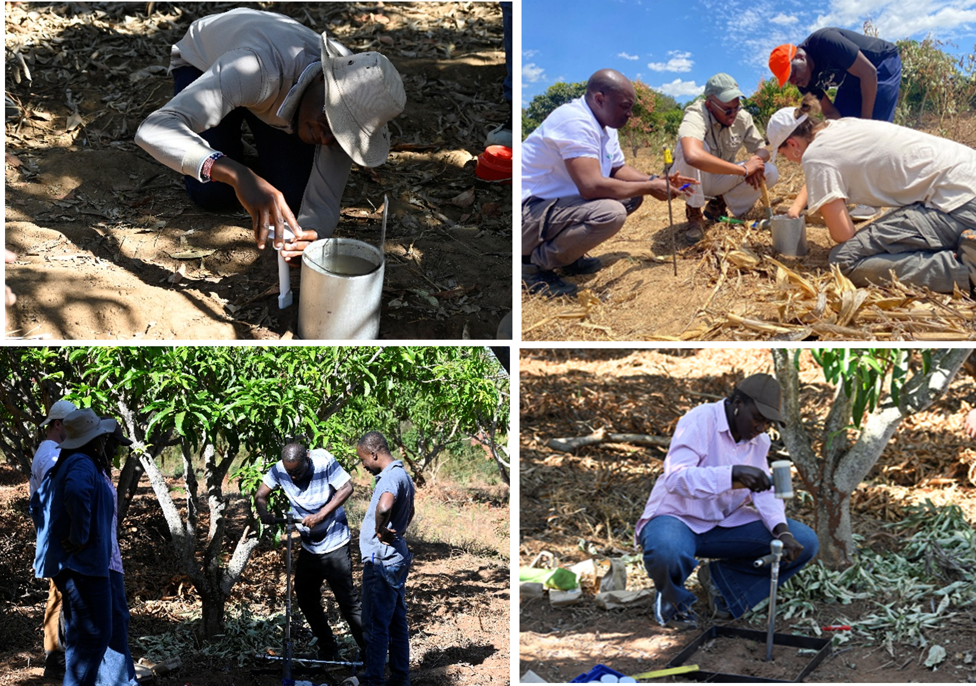
Conducting soil health assessments.
Soil Health
Understanding soil health conditions is a key element of understanding agroforestry systems. The workshop participants learned how to set up and name a soil health monitoring plot with a minimum area of 400 m² (20 m x 20 m), and how to randomly select nine soil sample collection points within these plots using a random number generator. Then, participants learned how to assess water infiltration in soil using an infiltration ring, measure soil moisture using the TOMST standard data loggers, collect soil samples using an open auger and bulk density ring, and how to pack and label soil samples properly using the protocols from the ICRAF soil laboratory.
Vegetation Structure
This part of the training focused on characterizing the spatial arrangement, density, composition, and vertical structure of trees and the influence of shade provision within agroforestry systems. This involved counting the number of trees in a plot, recording the number of stems per tree, assessing tree height using a rangefinder, estimating overhead canopy density using a densiometer, and measuring diameter at breast height (DBH) of all trees using a calliper and a tape measure. The vegetation measurements are help to compare different agroforestry designs and management practices.
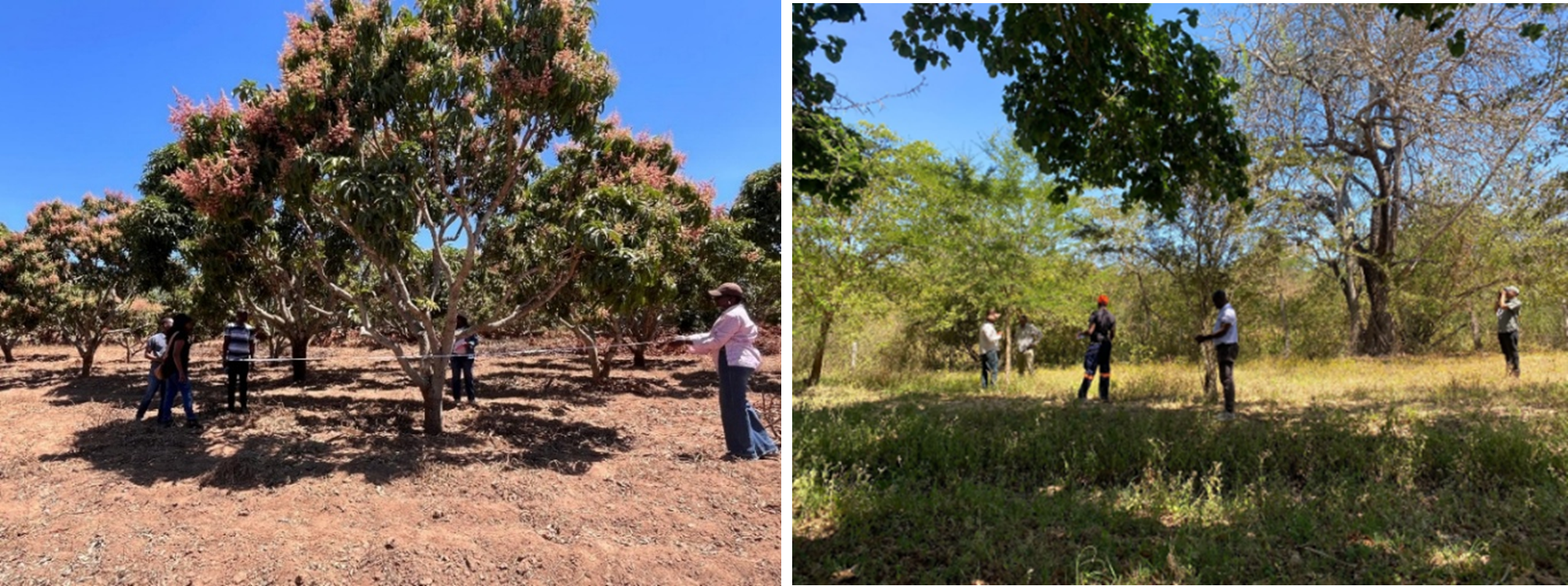
Vegetation assessments.
Insect and Microbial Biodiversity and Airborne eDNA
AfroGrow partner ICIPE led a session on monitoring insect and microbial biodiversity monitoring and airborne eDNA sampling. This involved standardizing the deployment, operation, and maintenance of Malaise traps for passive collection of flying insects. The trap intercepts flying insects along their natural flight paths, funneling them into a collecting head where they are preserved in a bottle for identification, characterization and further analysis.
To complement the largely physical and mechanical approach of Malaise trapping, participants were introduced to environmental DNA (eDNA), a molecular method used to detect and identify insects from genetic material found in the environment. DNA carries the genetic information needed for an organism’s development and function, and eDNA analysis makes it possible to detect insect presence and diversity from traces they leave behind, such as fragments shed as they move through the environment.
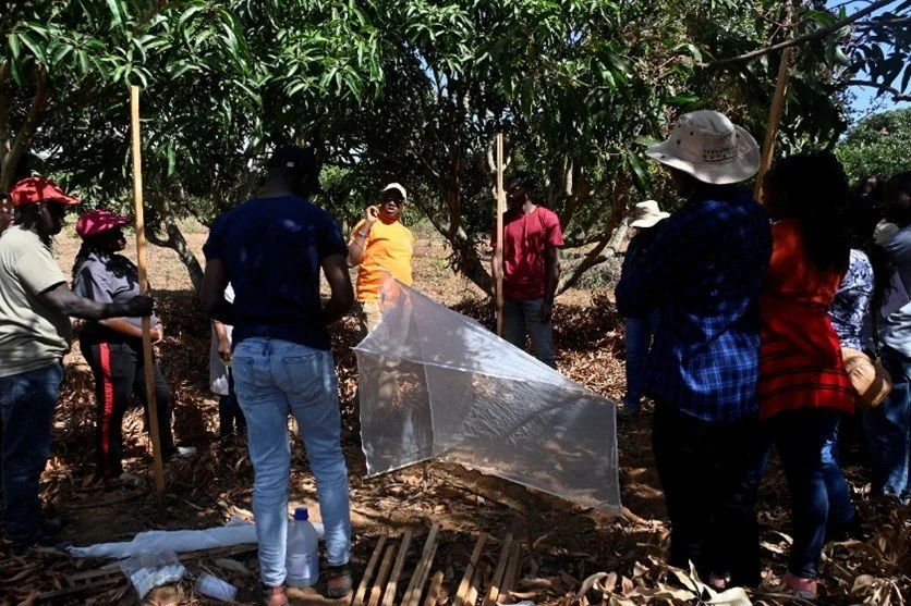
Setting up the Malaise trap.
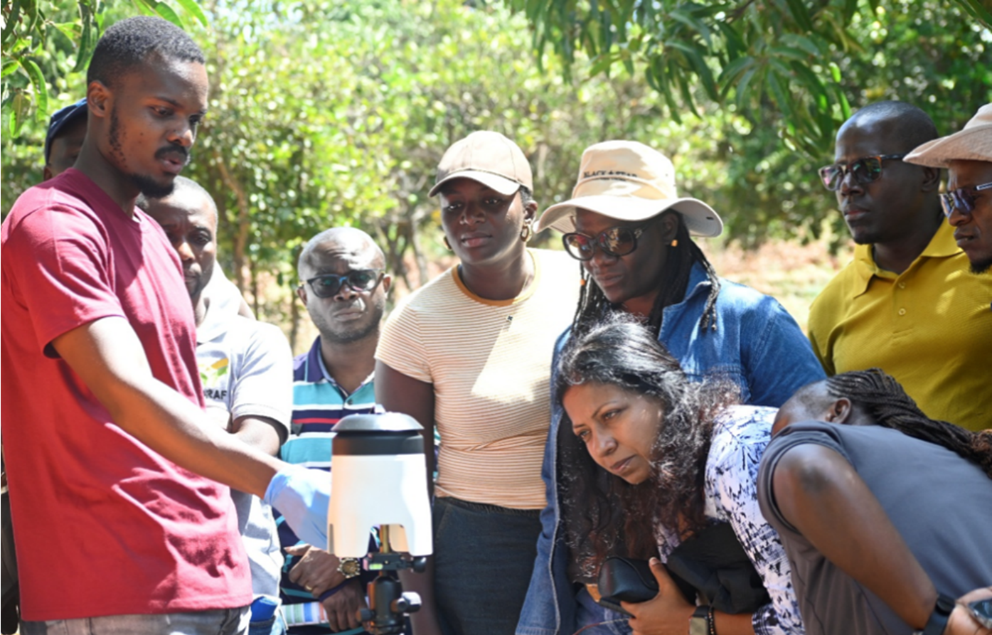
eDNA extraction from traps.
Microclimate and Weather Data
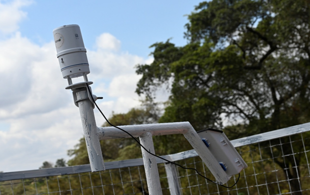
Trans-African Hydrometeorological Observatory automatic weather station.
This session involved training on the use of TAHMO (Trans-African Hydrometeorological Observatory) weather stations. The training equipped participants with practical skills to support the installation, operation, and monitoring of TAHMO stations within their respective Living Labs. The data generated will provide valuable information for understanding local weather and climatic conditions, supporting agroforestry research, climate resilience planning, and evidence-based decision-making across the Living Lab landscapes.
The weather data collection training session involved the installation of an automatic meteorological station, operation, cleaning, and data collection from the logger. For the project, the site-based data will be used to monitor environmental and atmospheric changes. To collect high-quality climate data, the session included installation of the TAHMO weather station, cleaning, and data management. Factors to be considered for set up included the direction of sunrise for solar radiation for battery charging needed for powering the data logger, and a wide area free from obstruction from trees or nearby buildings.
Heat Stress Tracking
Trainers demonstrated the use of the Kestrel instrument, which measurses heat stress by recording variables such as air temperature, relative humidity, wind speed, heat index, and thermal work limit. The session involved training on the installation and use of the instrument to assess microclimatic conditions in agricultural and agroforestry systems. The AfroGrow project will use these monitoring trackers to compare shaded agroforestry systems with open-field farming environments.
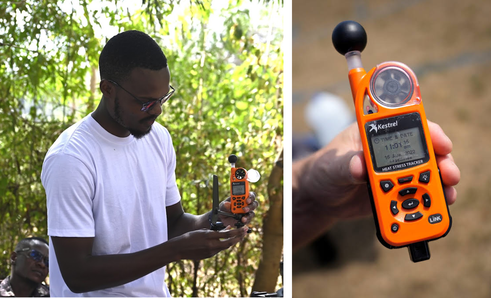
Using the Kestrel heat tracker instrument.
Bioacoustics
The project uses AudioMoth acoustic loggers to monitor birds, primates, and bats in the agroforestry sites. Participants were trained to install the instrument, assign bird, primate, and bat configurations, select sampling periods, and manage routine field visits.
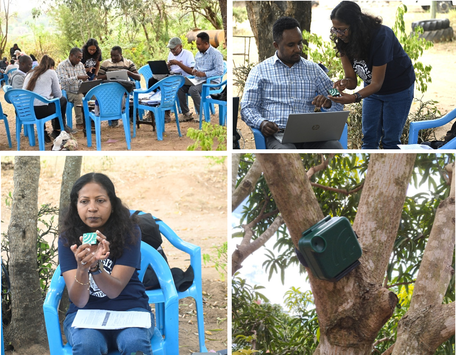
The AudioMoth bioacoustics instrument and its deployment on a tree.
Data Management
The data management training focused on strengthening participants’ ability to organize, document, store, check, and share data generated through project activities. The session emphasized good data management practices, including consistent file naming, metadata documentation, version control, quality checks, secure storage, and clear procedures for sharing data among partners. Participants discussed how well-managed data improves transparency, supports analysis, and enables comparison across different agroforestry living labs.
Summary
The workshop strengthened participants’ technical skills and improved their capacity to assess and monitor multifunctional agroforestry systems using harmonized field methods. This will lead to standardized data collection through the use of instruments, sampling procedures, metadata, and quality-assurance protocols, which will help with cross-country knowledge sharing and adaptive managemennt of agroforestry systems health. Through participation in this workshop, a stronger cross-country collaboration among participants and trainers was developed, and which will enhance coordination among project partners for effective long-term monitoring and implementation.